Groundwater Exploration from Space — Finding Water Beneath the Desert
In arid lands, every dry borehole costs time and capital. GeoMine AI fuses radar, optical, thermal and gravity satellite data with AI to map where groundwater is most likely to be found — so your geophysics and drilling go straight to the highest-potential targets.
Screen Thousands of km² Before You Drill
Satellites see the surface clues that point to water underground — buried channels, fractures, moisture and rock types — across entire basins, in weeks rather than seasons.
Evidence layers fused into one groundwater-potential map
Sensor families: optical, radar (SAR), thermal and gravity
Potential classes ranked to prioritise drilling targets
Field mobilisation needed for the first regional screening
The Challenge — Drilling Blind Is Expensive
In desert regions, groundwater is the lifeline for agriculture, mining, new cities and communities — but it is hidden, unevenly distributed and costly to locate.
Why traditional exploration struggles:
- Vast, remote areas with little existing hydrogeological data.
- Ground geophysical surveys are slow and expensive to deploy over large areas.
- Every dry or low-yield borehole adds significant cost and delay.
- Aquifers are under pressure, so new sources must be found and managed sustainably.
Result: decisions on where to drill are often made with too little evidence.
What GeoMine AI Delivers
A clear, evidence-based answer to one question: where should we look for water first?
Key deliverables:
- Groundwater Potential Zone (GWPZ) map, ranked high / moderate / low.
- Lineament and fracture-density maps highlighting likely recharge and flow paths.
- Buried palaeo-channel and drainage mapping from radar imagery.
- Shortlist of priority sites for ground geophysics and test drilling.
- Ongoing monitoring of wells, irrigation and land subsidence (optional).
Our maps do not replace drilling — they make every survey and every borehole count.
The Science — Reading the Desert's Hidden Signals
Water leaves fingerprints at the surface. GeoMine AI reads them from orbit and combines them in a GIS-based multi-criteria model.
Evidence layers we analyse:
- Radar (SAR): can see beneath thin, dry sand to reveal buried river channels, and tracks ground subsidence from aquifer depletion (InSAR).
- Structural geology: faults and fractures that store and channel groundwater.
- Lithology and soils: multispectral and hyperspectral mapping of permeable formations.
- Thermal and moisture: anomalies and vegetation signals linked to shallow water.
- Terrain and gravity: elevation models for drainage and recharge, plus regional water-storage trends from satellite gravity missions.
How It Works
From orbit to drilling decision in four steps:
The GeoMine AI groundwater workflow:
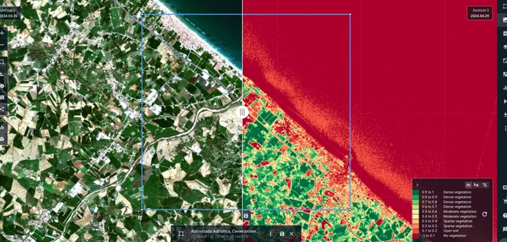
- Acquire: SAR, optical, hyperspectral, thermal and elevation data over your area — archive or tasked.
- Process: calibration, correction and fusion with your existing wells, geology and geophysics data.
- Model: AI/ML and weighted multi-criteria analysis to rank groundwater potential, validated against known wells.
- Deliver: maps, a technical report and a prioritised target list your hydrogeologists can act on.
Why GeoMine AI for Groundwater
Built by a Saudi-licensed Earth Observation company with 30+ years of technology leadership behind it.
What sets us apart:
- Remote-first: regional screening without field mobilisation.
- Multi-sensor: radar, optical, hyperspectral and thermal in one workflow.
- Desert expertise: hands-on remote-sensing work across Saudi Arabia and Egypt's Western Desert.
- Ecosystem: Microsoft partner and member of the ESRI Startup Program.
Start with a Pilot
We prove value on your own area before you scale.
How engagement works:
- Desktop screening: a first groundwater-potential view of your area of interest.
- Scoped pilot: a defined area, validation against existing wells, clear KPIs and agreed deliverables.
- Scale: basin-wide mapping and recurring aquifer and well-field monitoring as an annual subscription.
Data Sovereignty & Water Security
Groundwater data is national strategic information. We treat it that way.
Our commitments:
- Local processing and storage options in Saudi Arabia.
- Built around national data-governance and cybersecurity requirements.
- Role-based access and full client ownership of results.
- Responsible-AI principles: explainability and human (hydrogeologist) oversight.
Who It's For
- Water authorities and ministries
- Agricultural investors and desert-reclamation projects
- Mining companies needing process and camp water
- Giga-project and new-city developers
- Drilling contractors and hydrogeology consultancies
- NGOs and development agencies supplying rural communities
 From Pixels to Water
Beneath the desert lie ancient rivers, fractured rock and aquifers waiting to be understood. Satellites reveal the clues; AI connects them.
GeoMine AI turns those clues into clear drilling priorities — helping water, agriculture and development leaders find water faster, spend less and manage it sustainably.
Ready to Map Your Groundwater Potential?
Share your area of interest and we will propose a focused groundwater screening pilot.